Becoming a Smallmouth Cartographer
Since youth, I’ve had a unique interest and fascination for mapping and cartography. Whether I publish articles, present a seminar, or host my guests for a day on the water, one of the many subjects I will touch upon is how smallmouth bass (and largemouths too!) relate to underwater structure and cover, and why they are doing what they’re doing. I will then say something along the lines of utilizing your electronics and lake maps in order to find them.
Yeah, and a lot of people still don’t know how. Being adept in mapping and chart reading helps anglers learn how and why bass might be relating to the specific locations they’ve been located at and caught from. This will help you fish smarter and more efficiently in the long run, and help you eliminate unproductive periods of fishing.
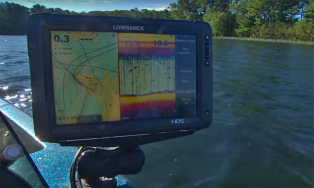
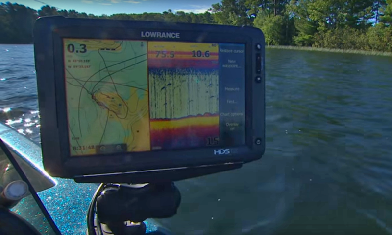
I run a combination of Navionics HotMaps Platinum and Lowrance Lake Insight HD charts for my Lowrance units. On every lake I fish (unless there is no map and ultimately I’ve had to chart or draw my own homemade) these are my #1 essential tools in helping me locate potential fish holding spots, running their course, and maintaining boat position. Like operating a desktop computer, the power of our marine electronics is infinite nowadays, and I keep learning new things with my units almost daily.
During the winter off-season, I keep my Navionics HotMaps Platinum chips updated. Additionally, I frequently use Navionics WebApp. I browse this mapping website often and frequently on the desktop computer. I use it for boating and fishing in order to further study my lake’s topography, and contours. This app helps me to better learn my lakes, understand the locations I’m fishing + why I should fish them, and identify key bass locations I am going to fish spring thru fall so I’m well prepared prior to my outing.
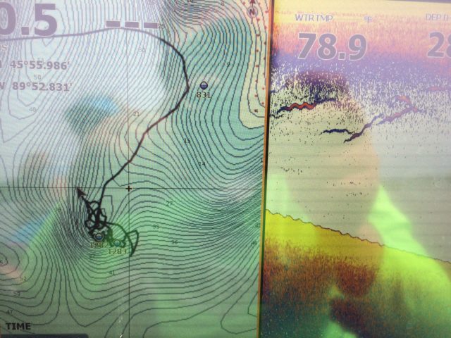
Unique offshore structures like this small secondary point can be midsummer smallmouth bass magnets.
Unless they are suspending over the thermocline in mid summer, smallmouth bass are frequently relating to structure. I always say the more contour a smallmouth lake has, the merrier. Often it’s true. Whether in shallow or deep water, these fish are always using and relating to these underwater courses for their traveling routes, feeding, and seasonal migrations. Map and chart reading, and having the ability to identify potential spots and differentiating contour lines, is an essential tool in furthering your bass fishing game. Map reading skills are ultimately acquired and enhanced through time on the water and user- experience during fishing and boat navigation.
I grew up learning many of my lakes with paper map only…… without the fancy electronics, side and down imaging we equip ourselves with nowadays. I feel better off having learned the old fashioned way.
Spots are so clique in bass fishing and I’ll never fish an area just for the sake of fishing it. It’s gotta have a purpose, and my time invested in it must have reason. In order to be a good bass angler, you’ve got to think beyond a spot. Understand the big picture for why it’s being fished. Visualize what could be happening underneath the boat. When results are had, process why that bass was there, and what made it be a good spot at the time you were catching.
As I navigate us around the lakes we fish, one of the many incentives of fishing with me for the day is acquiring the basic skills of map reading and cartography. I help comprehend what’s on the screen and happening below the surface, explain why we may be fishing a specific location and why fish could be using a particular spot. The more you learn and understand, the better off you will be applying newly acquired/improved skills to your next bass fishing adventure.
Save it. Bookmark it. Best fishing tool I keep handy on my desktop.


